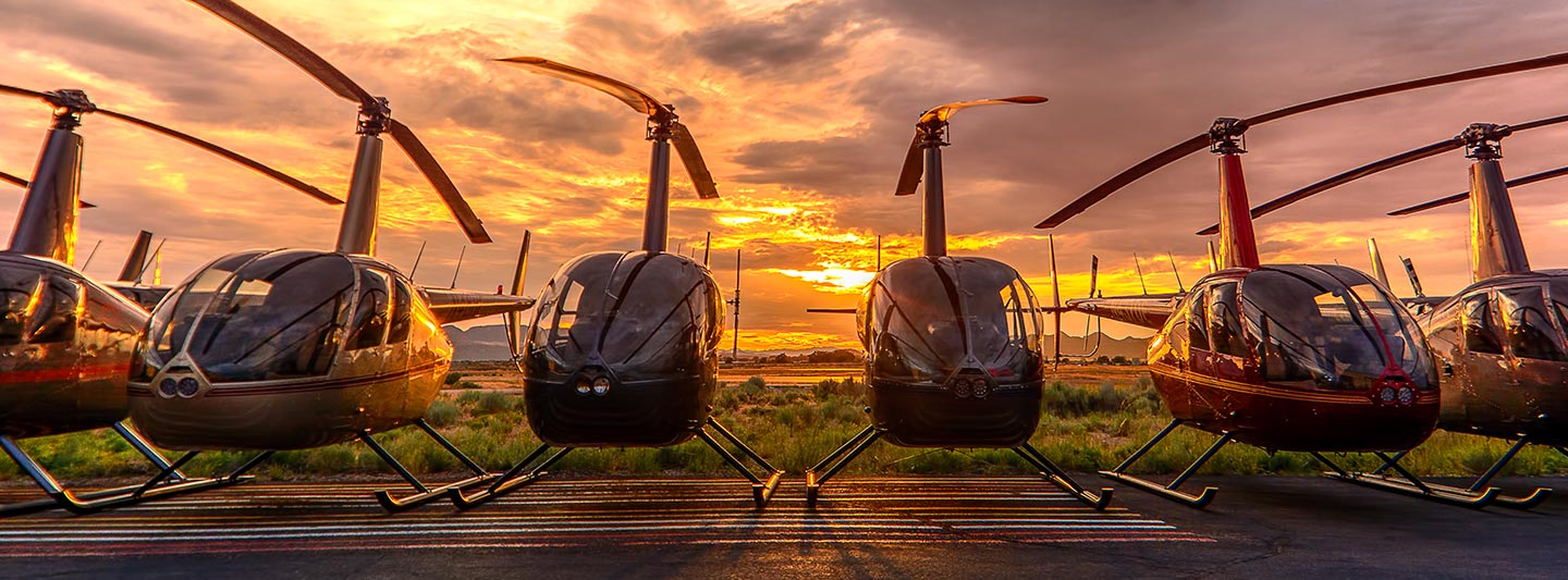
Precision Aerial Surveying, Photography, and Videography
Elevated Perspectives for Wisconsin
For any aerial survey requirement across Wisconsin, Green Bay Helicopter Charters offers comprehensive solutions leveraging the precise low-altitude and hovering capabilities inherent to helicopters. This includes highly specialized applications such as magnetometer and electromagnetic surveys, LiDAR data acquisition, and Geographic Information System (GIS) mapping. Furthermore, we facilitate advanced aerial filming and photography services, providing access to professional-grade equipment and operational configurations, including door-off flight for specific optical requirements. Our expertise ensures optimal data capture and visual content generation, offering a robust platform for critical projects throughout the Green Bay metropolitan area and surrounding regions.
Aerial
Surveys
LiDAR, GIS Maps, FLIR, HD Video & More
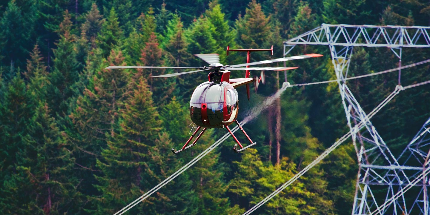
Green Bay Helicopter Charters provides essential aerial support for critical infrastructure projects, from pipeline inspections and right-of-way (ROW) surveys to transmission line patrols and maintenance assessments. We ensure access to appropriately configured helicopters and specialized equipment, vital for executing these projects with precision, efficiency, and unwavering reliability across Wisconsin's industrial landscape.
High Tech Results
The Top Pilots in Wisconsin, Today's Technology... Maximum Results.
Call 1-866-826-4826 Now!
Green Bay Helicopter Charters provides the tools needed to complete your land surveys, utilizing the right equipment to provide the aerial photos that are often needed.
An expertly executed aerial survey significantly streamlines right-of-way (ROW) and site inspections, facilitates precise topographical data acquisition, and enables high-definition photographic documentation for critical commercial and infrastructure projects. Helicopter-based surveys offer an unmatched vantage point for detailed assessments of Wisconsin's diverse terrain, providing crucial insights for pipeline integrity checks, proactive detection of transmission line anomalies, and comprehensive visual records of expansive properties. Green Bay Helicopter Charters specializes in developing tailored photographic and remote sensing operations, meticulously designed to maximize both technical efficacy and financial efficiency, thereby ensuring superior project outcomes.
Helicopters offer distinct operational advantages over fixed-wing aircraft for critical aerial surveying applications due to their exceptional low-speed and low-altitude flight characteristics. While Federal Aviation Administration (FAA) regulations mandate fixed-wing aircraft maintain a minimum of 1,000 feet above the highest obstacle, helicopters possess the unique capability to operate at significantly lower altitudes. This allows for precise, detailed inspections of infrastructure and terrain, including challenging or hazardous zones, providing engineers and project managers with invaluable, otherwise inaccessible perspectives vital for comprehensive assessment and planning in Green Bay and across Wisconsin.
There is no better way to conduct your visual survey, animal population counts, soil drainage analysis, ROW inspections, pipeline and transmission line inspections, and geographical surveys.
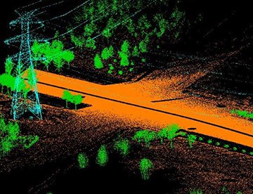
LiDAR Imaging
Light Detection and Ranging, or LiDAR, is a remote sensing method used to examine and measure Wisconsin topography as well as objects, like vegetation, upon it.

Infrared Imaging
Thermographic IR cameras are used to detect radiation in the long-infrared range of the electromagnetic spectrum and produce images of that radiation, called thermograms.
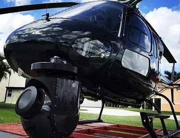
HD Video Gimbal Capture
Modern HD and 4K cameras can be mounted to helicopters, using the proper STCs, with a gimbal to stabilize photos & videos for detailed results.
Advanced Aerial Cinematography and Videography Solutions
For expert camera work in the Green Bay Sky
Get a Fast, free QuoteGreen Bay Aerial Cinematography
Green Bay Helicopter Charters provides unparalleled access to professional-grade aerial cinematography resources throughout Wisconsin. We facilitate custom production requirements by offering advanced technology, including sophisticated gyro-stabilized camera mounts such as Tyler Mounts, Wesscam, Cineflex, Pictorvision, and SpaceCam. These systems integrate seamlessly with specialty cameras like the Cineflex HD, RED Epic, and Arri Alexa, extending to 3D and experimental camera setups for cutting-edge visual capture. Whether requiring intricate air-to-air or dynamic ground-to-air perspectives, comprehensive support is available for all production goals. Expert aviation professionals collaborate diligently with aerial Directors of Photography and directors to achieve precise visual outcomes. Specializing in helicopter support for both still and motion photography, Green Bay Helicopter Charters is equipped to facilitate nearly every media-related operation across Wisconsin. This encompasses feature film production, television series, documentaries, promotional videos, commercials, aerial prop integration, essential relief work for news and broadcast networks, and critical coverage of historical events or major sporting competitions, utilizing a diverse fleet of suitable helicopters.
Call Us Today at 1-866-826-4826 for a Free Quote
Contact Us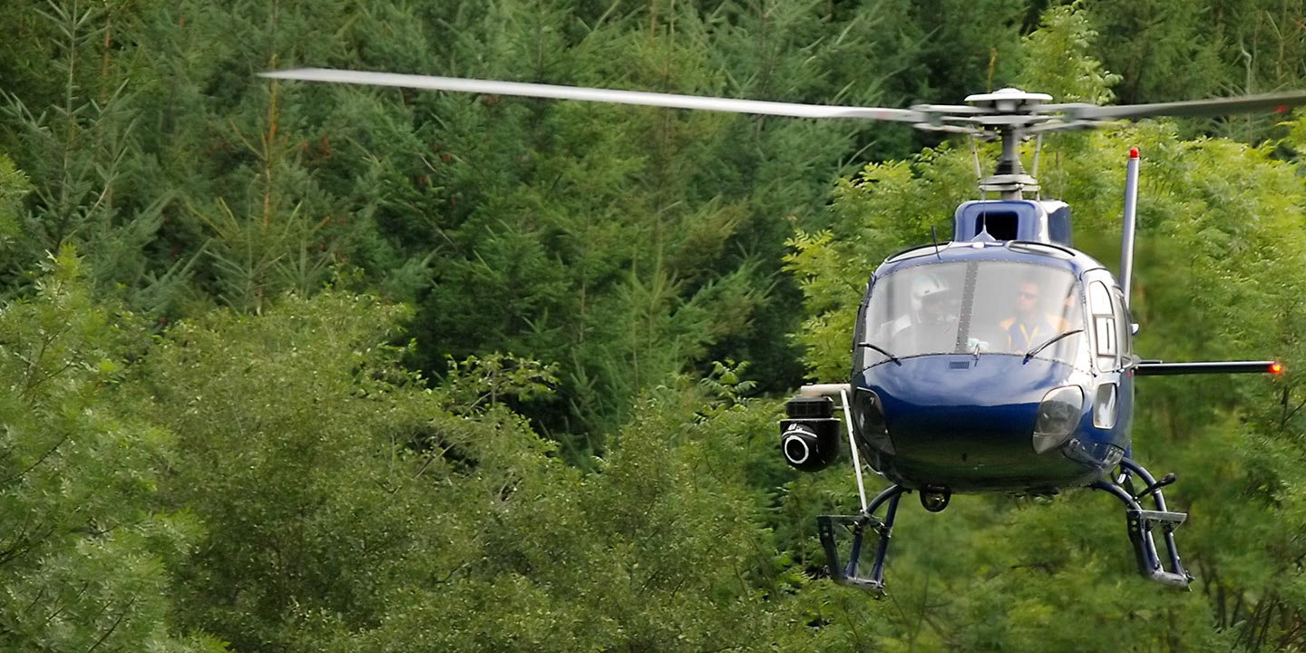
Aerial Photos
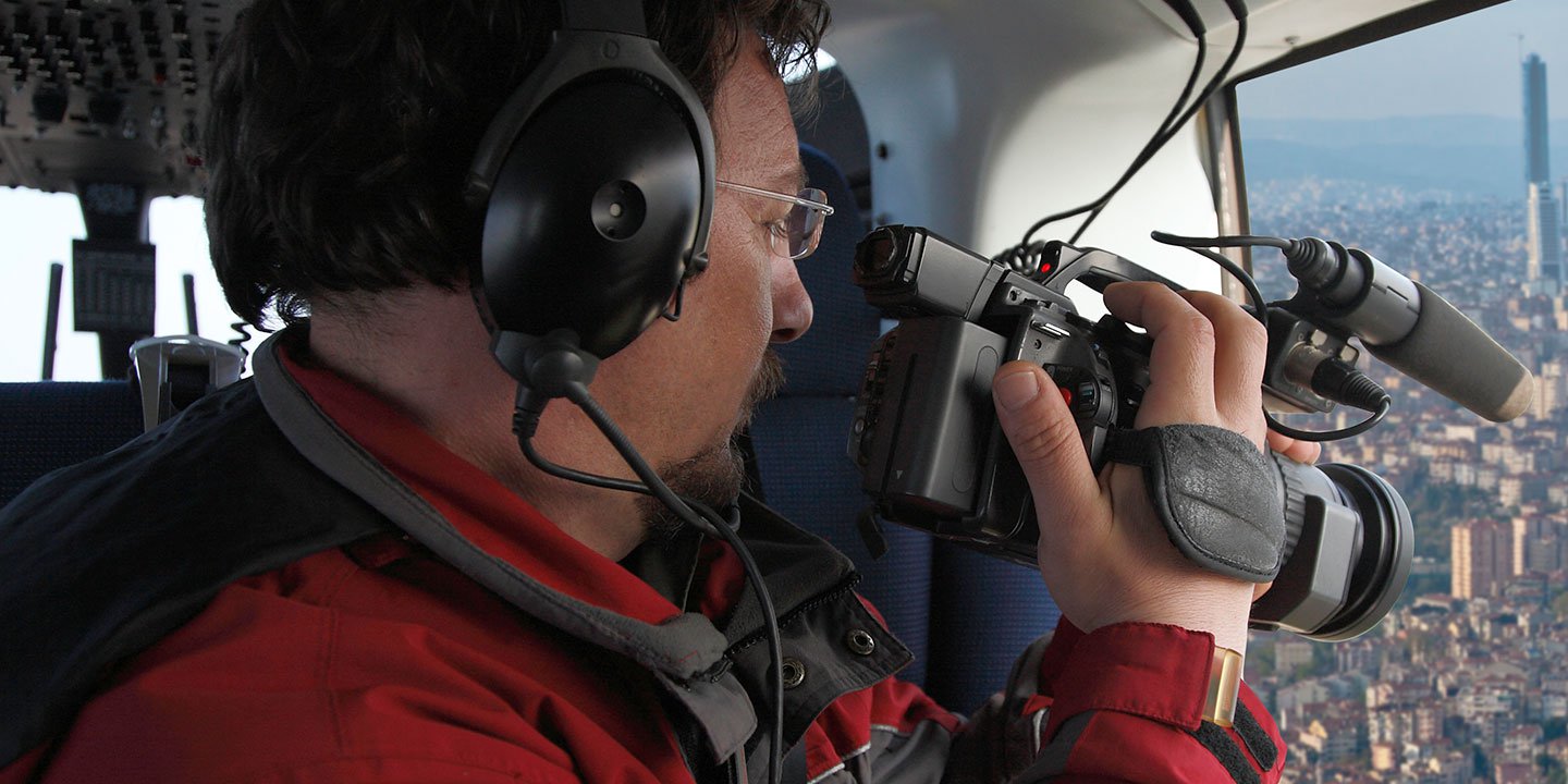
Hand-held or Mounted OpTions in Green Bay
We will help you get the right equipment for your aerial photography project! Call 1-866-826-4826 today to get a fast, free quote.
The Most Options for Photography
For capturing critical imagery across Wisconsin's diverse landscapes and industrial sites, the aerial perspective offered by helicopters is invaluable. Green Bay Helicopter Charters provides specialized aerial photography charter services, meticulously designed to facilitate the precise capture of your visual objectives. We ensure access to practical solutions for various photographic requirements, including the option for door removal to enable handheld camera operations. For enhanced stability and cinematic quality, information regarding advanced gyro-stabilized camera mounts is available upon consultation. Our commitment is to deliver highly efficient and cost-effective aerial photographic opportunities, enabling superior visual data acquisition for commercial, documentary, and creative projects throughout the region.
Superior Service
Every one of our customers gets a dedicated helicopter expert to assist with flight plans, tech loadouts, production logistics, project schedules, and other demands.
Over 500 Aircraft
Our network of direct air partners extends well beyond Green Bay, Wisconsin. This allows us to offer a wide range of solutions for even the most sophisticated projects.
The Best Equipment
From high-tech sensors like LiDAR, FLIR, and GIS to HD cameras and movie production gimbals, we're here to make your job as easy as possible.